IJ River’s Island Hill Bridge
Author name: Rodrigo Romero
Instagram: @rodrigoromero_design
Facebook: @rodrigoromerodesign
Website: https://rodrigoromerodesign.com/
The IJ River’s Island Hill Bridge is a destination, a landmark, and it also connects the South and North of Amsterdam over the IJ River.
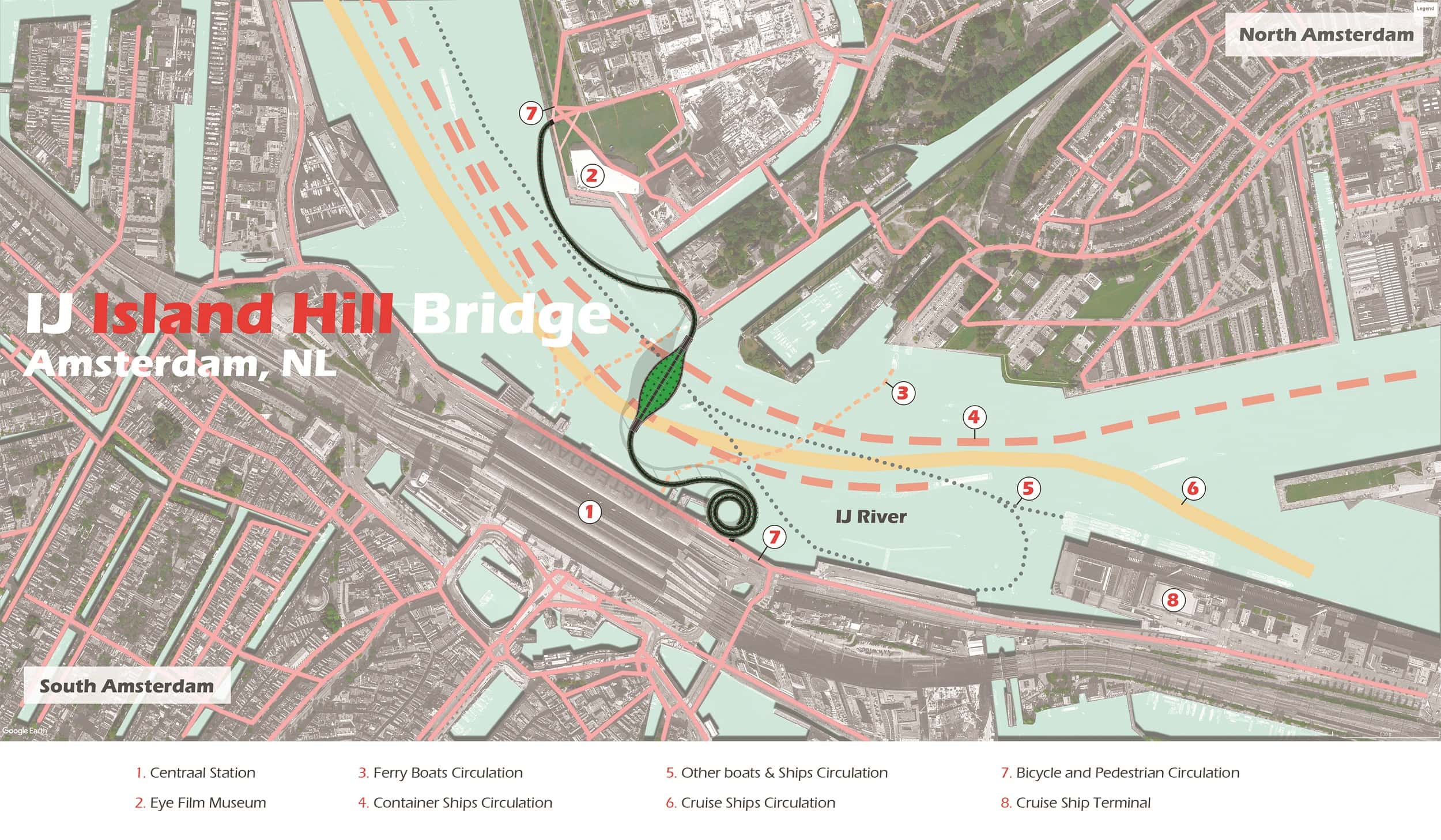
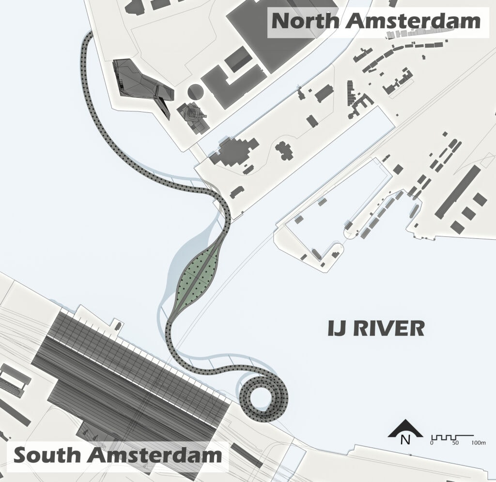
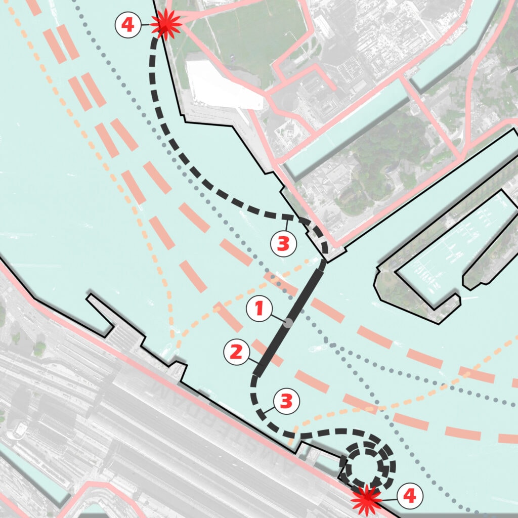
Located on the IJ River, in Amsterdam, Netherlands, the Island Hill Bridge connects the older Amsterdam-Zuid (South) part of Amsterdam with the newer Amsterdam-Noord (North), solving a major transportation issue.
The construction of a bike bridge in this area has been limited due to tall container ships and cruise ships that pass by on the river.
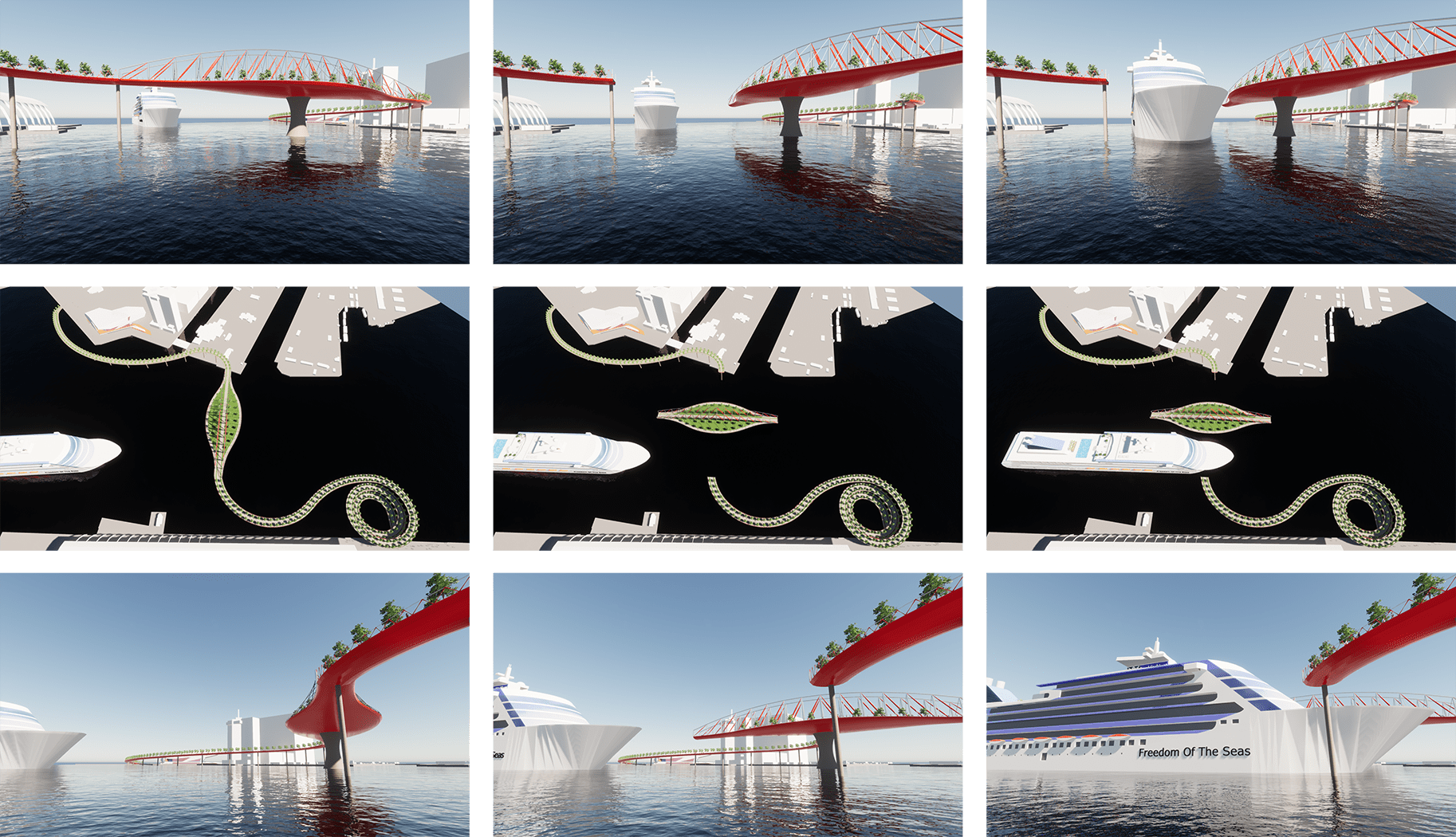
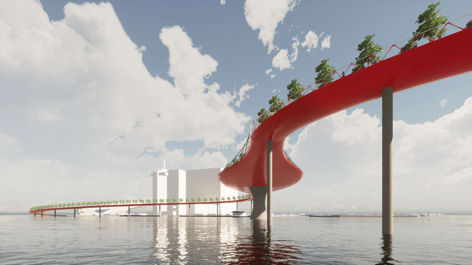
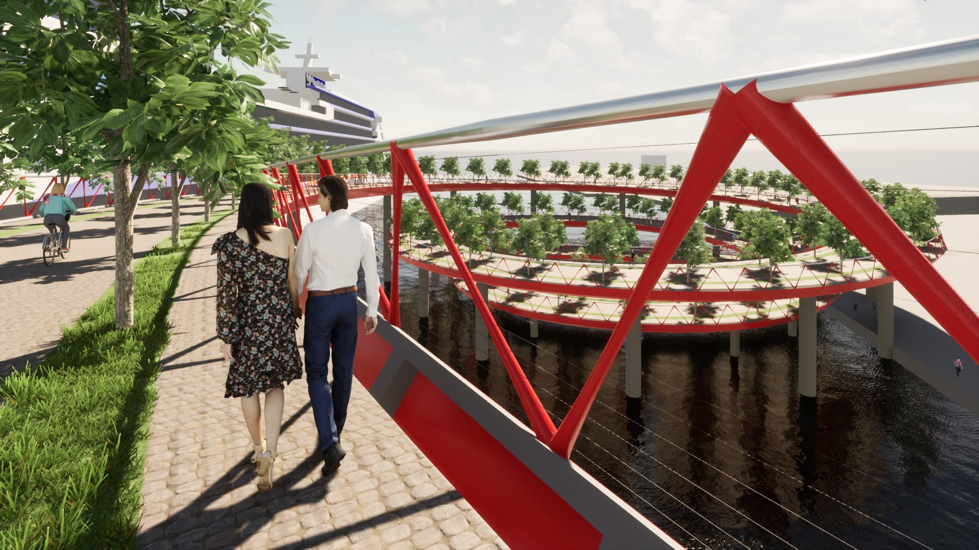
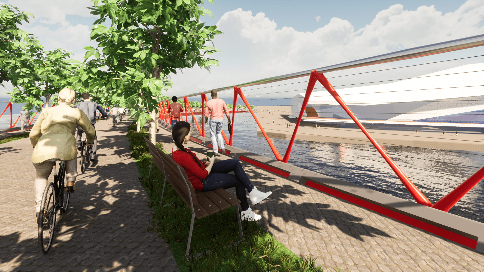
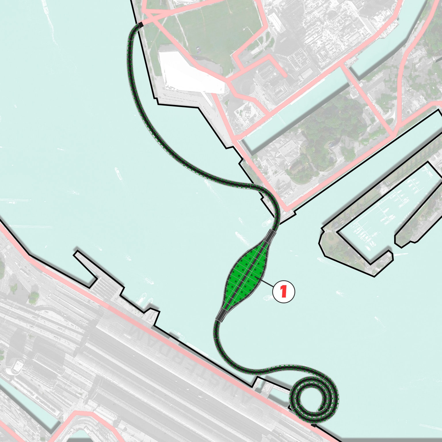
This proposal allows for container ships to pass underneath, and swings open for cruise ships to go by. The opening of the bridge could become a spectacular attraction on its own. In addition, the top of the bridge is the new Island Hill Park that offers stunning views of Amsterdam and the excitement of turning into an island each time a cruise ship passes by.
Island Hill Bridge Swings Open
A Problem to Solve
First of all, I want to credit Non Architecture Competitions (https://www.nonarchitecture.eu/) because I learned about this issue through a competition they organized this year (2021). I started working on this as a direct response to their competition brief, however, I did not enter the competition as I offered a solution that was located on a different site than what the competition required.
IJ River’s Island Hill Bridge, Amsterdam, NL
Amsterdam is a vibrant city that established and grew dense on the south of the IJ River. Amsterdam’s South, East, and West are interconnected webs of channels, as well as bicycle, pedestrian, and automobile paths. However, bicycles and public transportation are mostly used in the city.
On the north side of the IJ River in Amsterdam North, which is a newer section, and it is growing in density every year. The problem is that there are not enough bicycle bridges or tunnels that cross the IJ River, so bikers need to cross the river by ferry boat. Public transportation works well and ferry boats are constantly active, however, they can get crowded and people may have to wait for a few minutes for the boat.
A bridge or tunnel would allow bikers (and pedestrians) to cross at any time, without having to wait for ferry boats to be active and available. Unfortunately, because the section of the IJ River closest to downtown (the densest area) is used for cruise ships (as the Cruise Ship terminal is right there) as well as container ships and many other ships and boats, building a bridge (or tunnel) has been a major challenge. Many proposals have been studied by the City of Amsterdam and its residents, and much discussion has taken place without a solution that satisfies everyone.
As I read Non Architecture Competition’s brief, I was very interested because I am familiar with the site. I stayed at a hotel in Java Island, just a block away from the site they selected for the competition, and I walked many times from there to Centraal Station, which is in the area where most pedestrians and cyclists are going to, or coming from. I analyzed the Java Island site and the Centraal Station site for the best possible solution I could find. If I found a solution worth discussing with others, I would develop it further.
For me, the Centraal Station site was more exciting than the Java Island site because it provided the best return on investment to the City of Amsterdam. I found a solution that seemed to offer many benefits, so I decided to develop it further even if it meant that I would not qualify for the competition. Since the purpose of Non Architecture’s competition was to establish a dialog about different solutions to Amsterdam’s issue (discussed above), I thought that continuing with this design would provide more value to the conversation.
The Island Hill Bridge would be a costly endeavor. However, I believe that it is an investment that would please the City of Amsterdam Infrastructure Department as well as residents from the neighborhood. This proposal solves most of the issues (that have been discussed many times in the past) without generating new problems (to the best of my knowledge).
Island Hill Bridge – Rodrigo Romero Design
Some of the benefits of building the Island Hill Bridge next to the Cetraal Station are:
- The bridge would be close to the densest areas of the city so it would be used by more cyclists, pedestrians, locals, and tourists.
- Locating the bridge next to the Centraal Station, as well as the bridge’s height and layout, make it a more visible and recognizable landmark.
- The bridge connects dense Amsterdam-Zuid with a growing Overhoeks in Amsterdam-Noord, connecting directly to the Eye Filmmuseum.
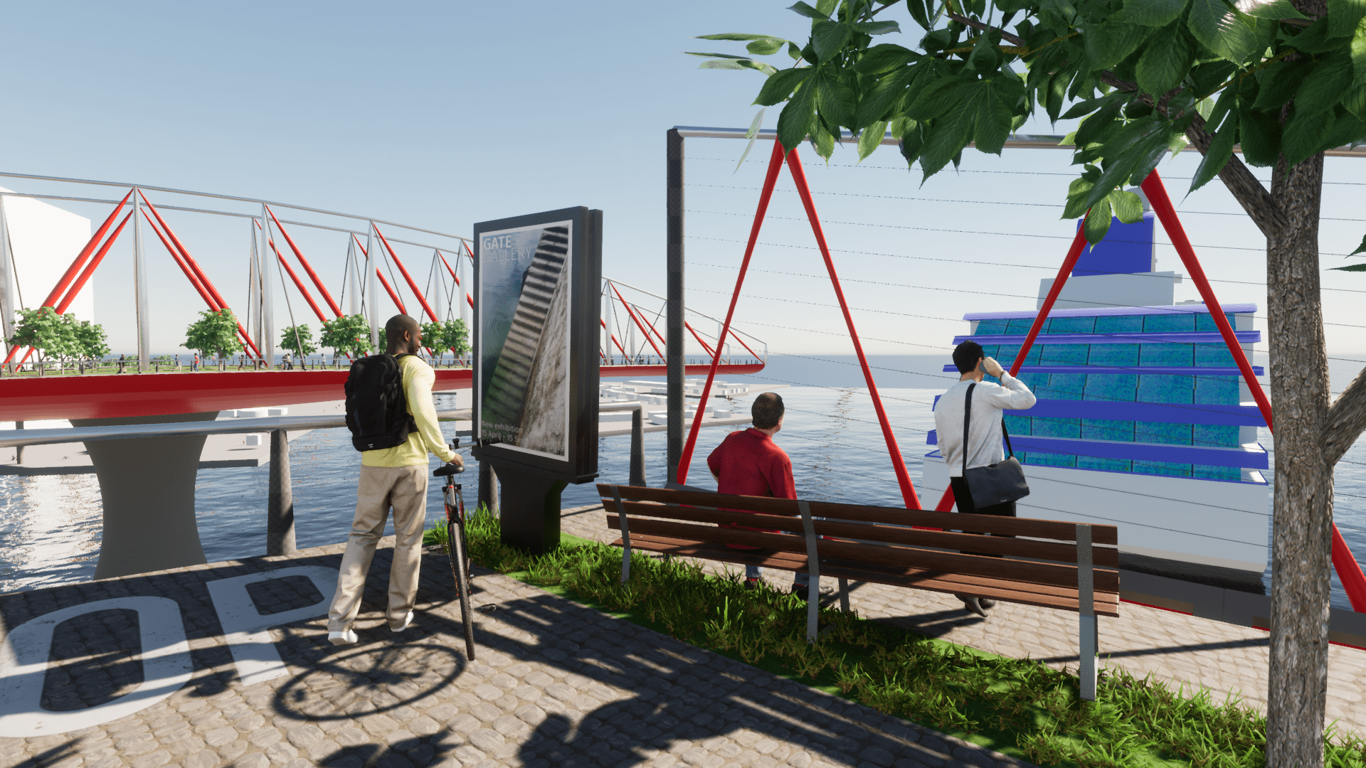
- Ramps are far away from buildings and become an attraction to view from afar. Ramps also provide great views, from different angles to the buildings.
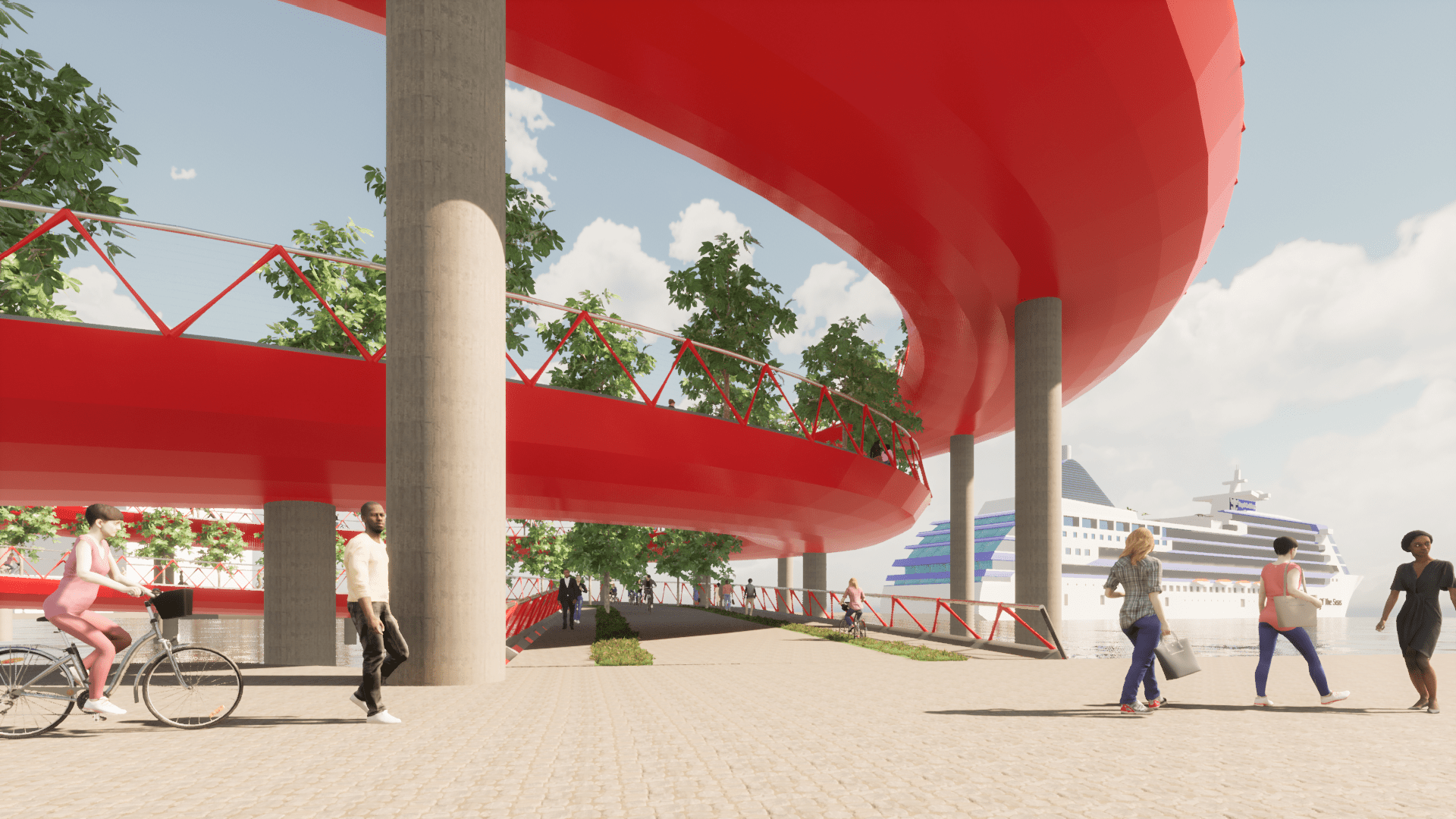
- The height of the bridge allows for container ships to pass under it without the need to open and close it many times a day.
- The bridge remains open to cyclists and pedestrians most of the time.
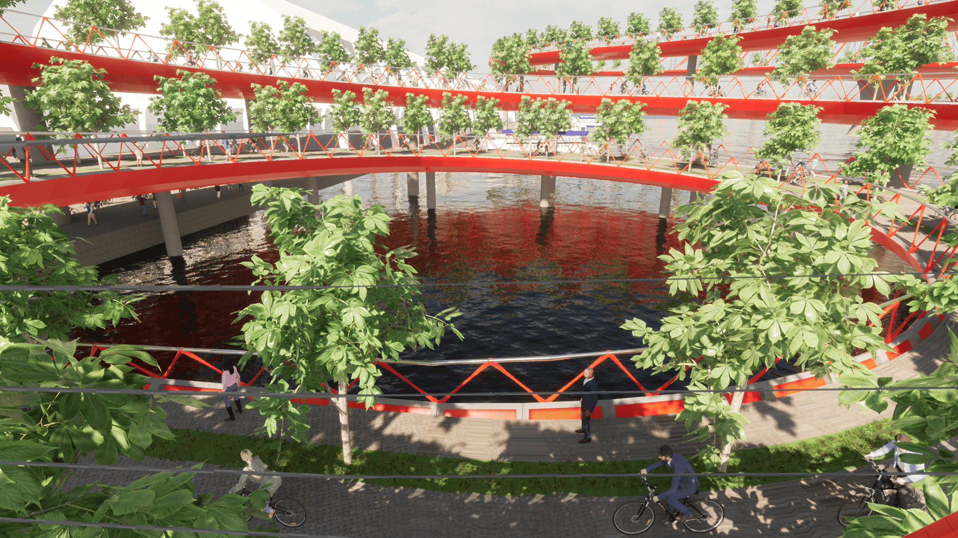
- The bridge only swings open when a cruise ship needs to pass by, then swings back when the ship has passed. This turns into an event that people would love to experience.
- The top of the bridge turns into a public park and provides views of the city that will attract locals and tourists alike.
Finding a Solution (Design Process)
The shape, structure, and overall design of this bridge were a natural response to the constraints of the site, uses, and structural and material needs. Everything in this design has at least one function other than aesthetics. As I tried to solve the different problems, I was presented with opportunities and possibilities that would not have existed otherwise.
The first challenge was to make the bridge high enough to allow for container ships and other boats to pass by underneath. This meant that, at the highest part of the bridge, there had to be at least 25 meters of height clearance between the water and the bridge above.
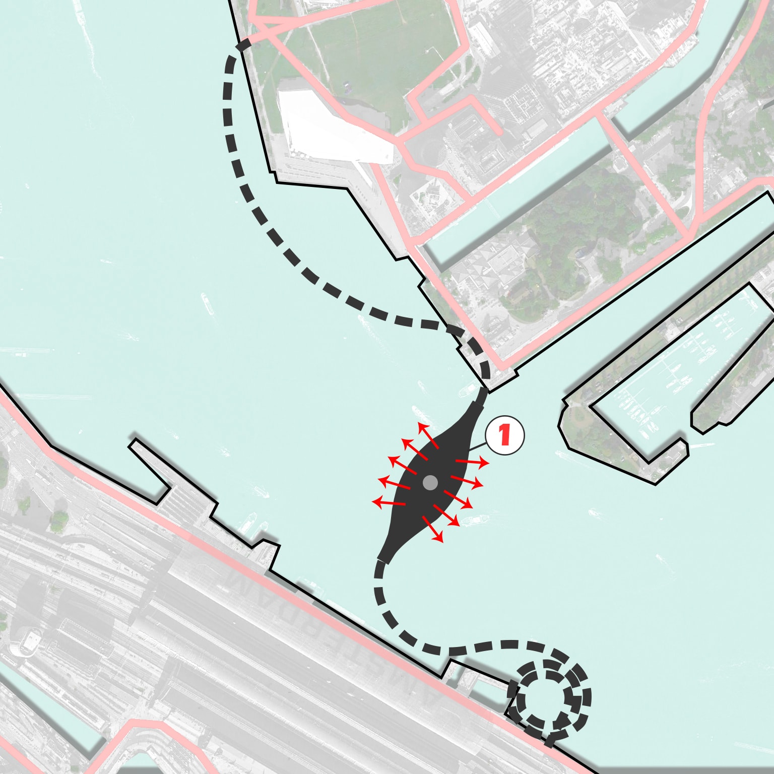
- The main support structure for the top of the bridge was located where it would not interfere with ongoing traffic.
- The top would also need to have long spans, wide enough for container ships to fit.
- A higher bicycle bridge meant that ramps had to be longer. For cyclists, a slope higher than 5% is considered a bit difficult, so the ramps had to be less than 5%. Ramps also had to be located far away from buildings, as to not block their views. Finally, ramps and their support columns could not interfere with existing traffic (boats, ships, pedestrians, cyclists, automobiles, trains).
- Location of entries to the bridge was dictated by existing bike and pedestrian circulation trends and by the constraints mentioned above.
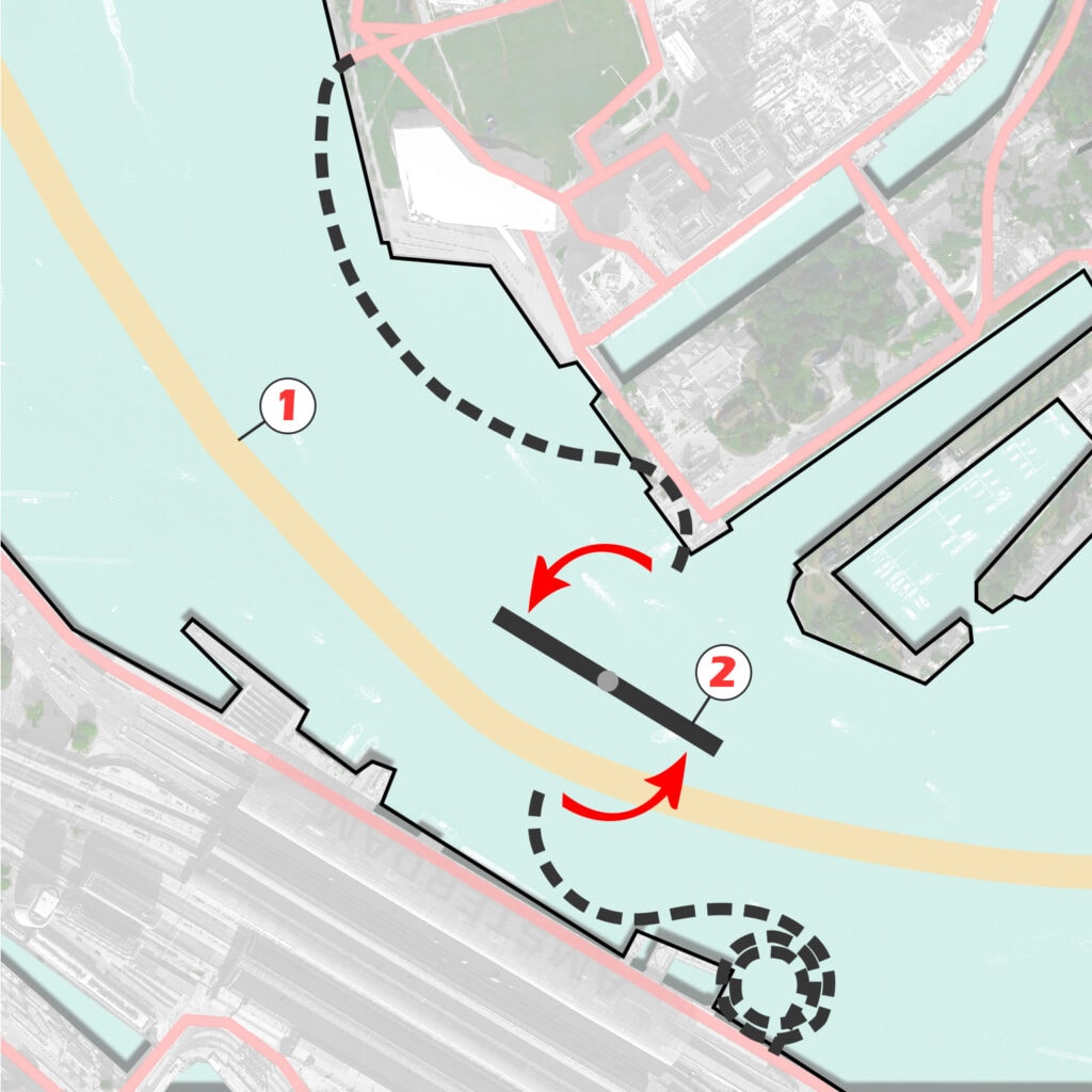
- Not to forget that cruise ships also have to pass by. The bridge could not be high enough to allow cruise ships to fit underneath, so…
- The top of the bridge swings open to let cruise ships pass by. It would take the bridge about 2 minutes to swing 90 degrees. Then, it would take the cruise ship about 3.5 minutes to pass by (at a speed of 4.34488 Knots or 5 miles per hour). So the approximate time the bridge would remain open is 7.5 minutes.
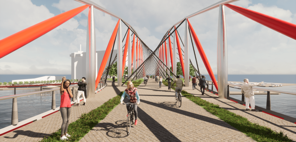
- With height come better views. As a response, the perimeter of the top of the bridge is modified to maximize views and to allow more people to enjoy the views at once.
Long and winding ramps can become tedious and tiring. However, if the top of the bridge is turned into a destination, with amazing views and plenty of places for rest and leisure along the way, the experience becomes more like being on a hill, and not just crossing a bridge.
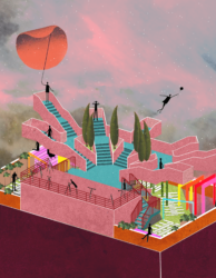
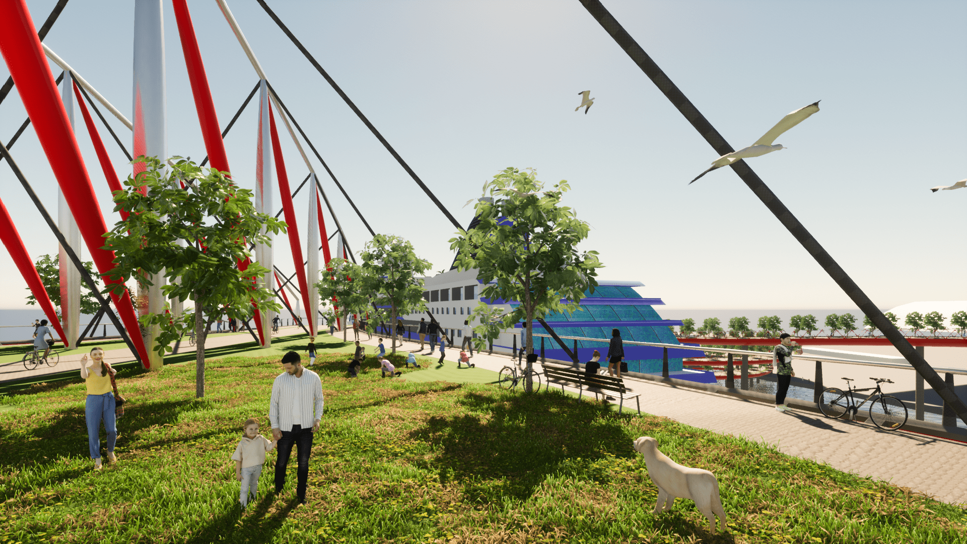
- What’s a hill without vegetation? Provide vegetation (grass and trees) along the ramps and at the top of the bridge. Now, the top of the bridge feels more like a park than a bridge. Welcome to Island Hill Park!
Vegetation
Trees and grass turn an inert structure into a lively ecosystem by attracting animals and insects, and providing shade and places for respite, play, and socializing. Trees should be spaced far apart so that wind pressure does not become a problem.
Rainwater
As it rains often in Amsterdam (about 200 days a year), no irrigation is necessary for the bridge’s vegetation. All paving should guide rainwater into the vegetated areas. Within the truss system, there is space for some rainwater collection to use if necessary. However, it is not likely to be needed. In fact, too much rainwater may be an issue, so excess water should drain down into the river.
Structure and Materials
All these features need to be structurally supported and we want to use as little materials as possible. We also want to use recycled or recyclable and reused or reusable materials where possible and a structure that can be disassembled if needed.
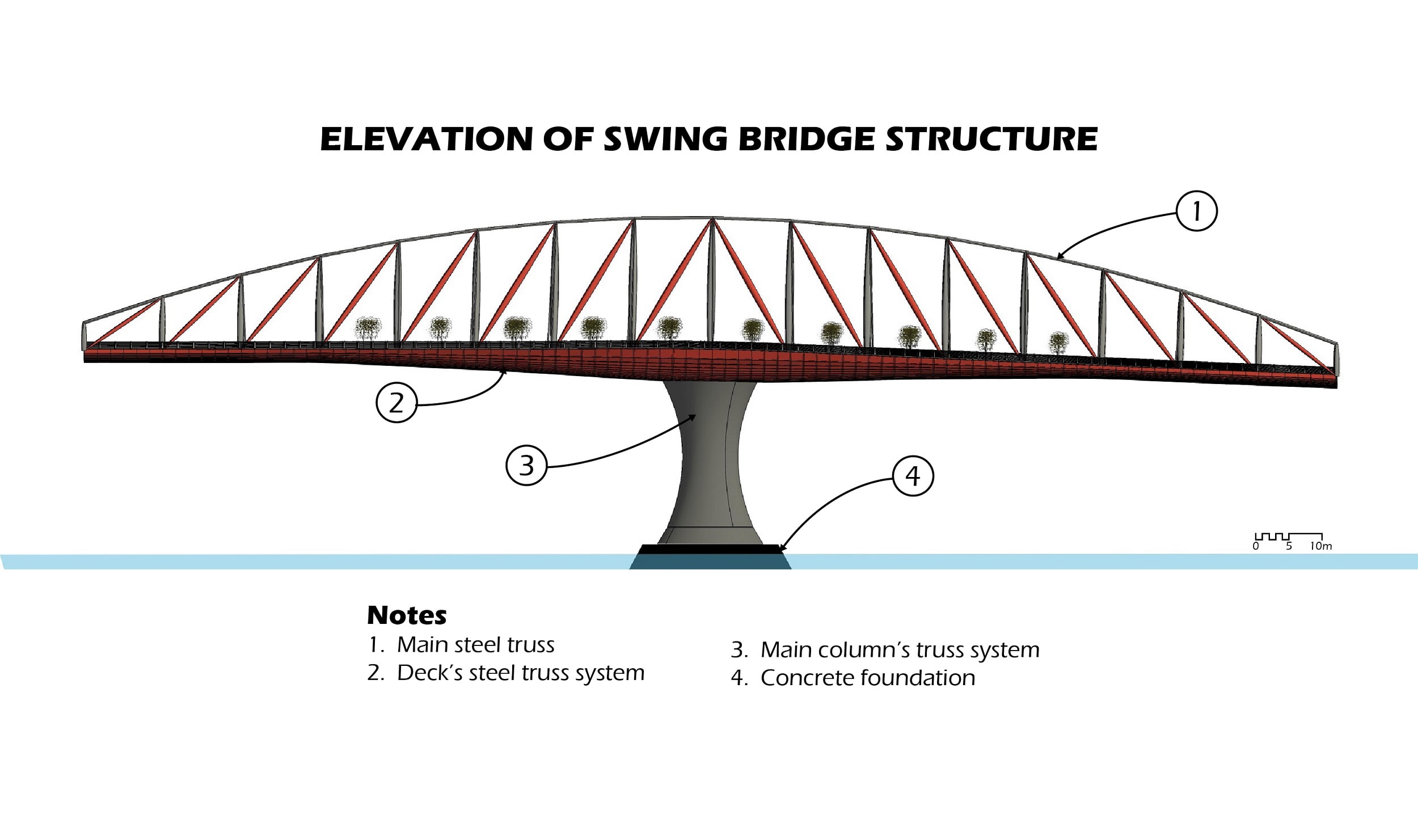
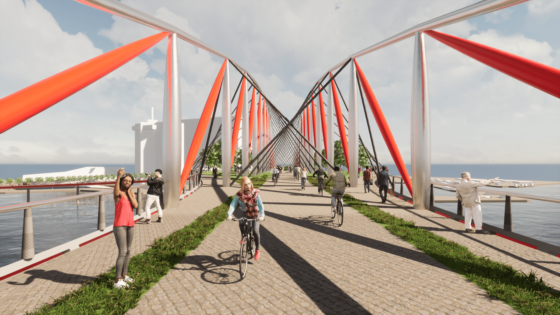
The top of the bridge is the swinging part of the structure. To allow for the structure to swing, it requires a single column that can support the whole swinging bridge. The swing bridge also needs to be able to span wide enough for 85m (279ft) wide cruise ships to easily fit when the bridge swings open. The best structure I found for meeting all these requirements was a mixture of a truss bridge (to support the structure longitudinally) with a suspension bridge (to support the decking transversally).
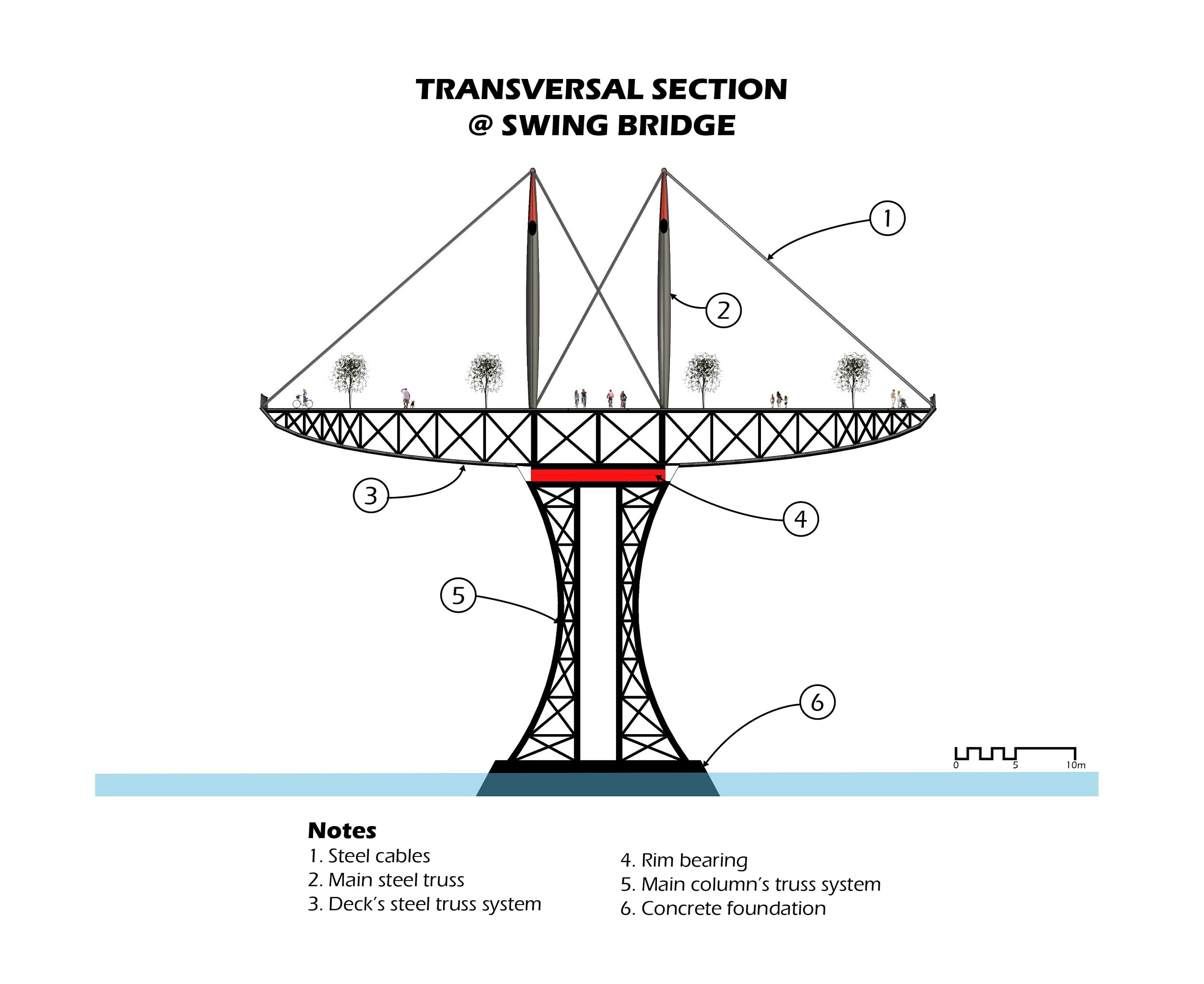
Because the main column is a spherical tower made of a steel truss system, it is hollow, with interior space being utilized for equipment, elevators, stairs, conduits, etc.
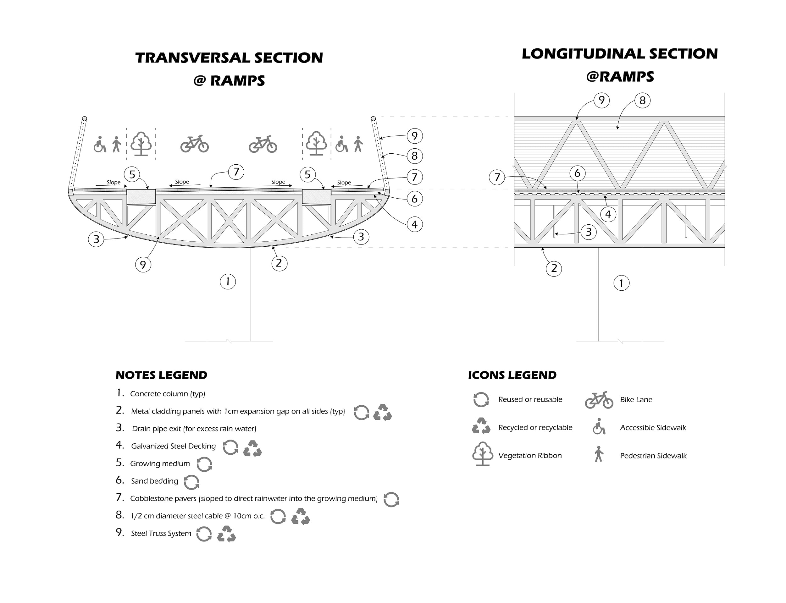
After locating the ramps, attention was given to allow as much of a span as possible without jeopardizing their structural identity. For this reason, as for requirements mentioned above, a steel truss system was also chosen for the ramps, allowing an average span of about 37m (121 ft).
The columns for the ramps are made of concrete, or a recyclable and/or reusable material with similar strength and durability.
To allow for reuse, rough (non-slippery) cobblestone (or a similar local material) paving was chosen for bicycle lanes and sidewalks, both on ramps and on the swing bridge.