DRONUMENT: Landscape mapping made collective-stream media
Team
Name: Camila Agudelo
Nationality: Colombian
Name: Luis Eduardo Gonzalez Vergara
Nationality: Colombian
– FINALIST of 2020 Monument Competition
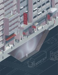
Today’s monument has a broader range of responsibilities than it ever has. It’s no longer conceivable to commemorate a specific character or event but it does make sense to memorialize the all-encompassing and history-rich scenario which is the territory. This image is based on the ‘Gran Malecón del Río’ in the Magdalena River in Barranquilla, Colombia (South America) where we found a perfect container for the contemporary monument. Because of the river’s magnitude it is nearly impossible to perceive its vastness in size and diversity, however if we could simultaneously visualize many points of view of its landscape we might be able to start conceiving the form and volume of this colossal watercourse. A future monument needs to be adaptable and dynamic to be able to create a relevant flow of present day history in a context of increasingly unpredictable spatial settings and accelerated circulation of online media. Based on these ideas, the drone system is continuously collecting visual data throughout the river bed, that is stored in a cloud and then projected on the surfaces of nearby public spaces, making it possible for anybody to experience the whole landscape concentrated in smaller areas.
#DigitalSpatialMemory # DigitalvsPhysical #LandscapeMapping #LandAccesibility #ImmaterialMonument


